Aridity Index
The UNEP aridity index (P/PET) from 85 years of ERA5 climatology — hyper-arid through humid on one dimensionless scale, with a per-pixel confidence interval. A byproduct of the drought v2 hazard chain, shipped at honest ERA5-native resolution. The whole bundle is ~2 MB.
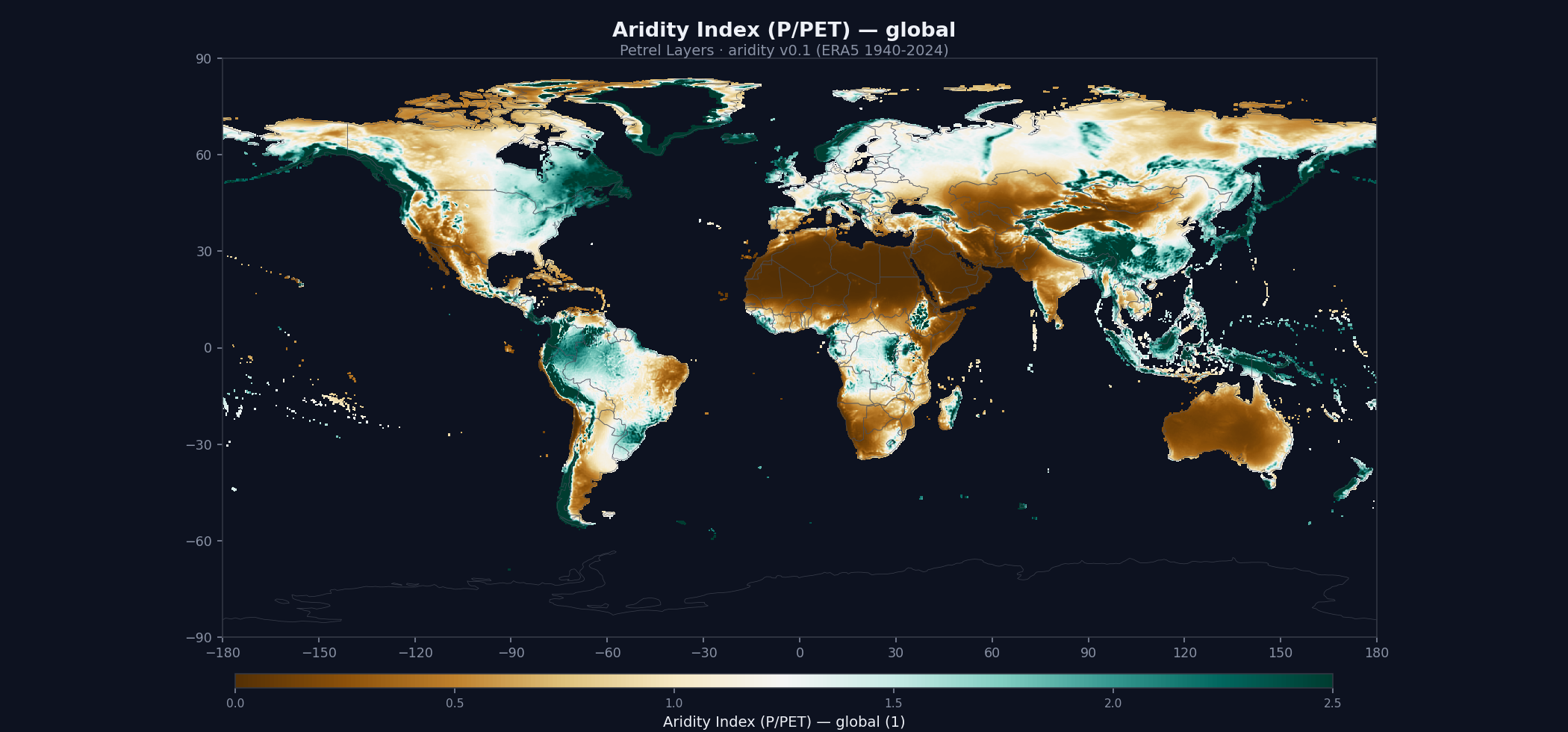
What ships in the bundle
3 global ~0.25° (~28 km, ERA5 native) GeoTIFFs (~2 MB total) plus the full documentation set. All files are Cloud-Optimized GeoTIFFs with internal tiling and overviews — fast for both bulk download and windowed reads.
Method
Inputs · ERA5 monthly precipitation + 2m temperature 1940-2024 (85-year climatology)
Training labels · —
Method · UNEP P/PET aridity index from the drought v2 climate chain (Thornthwaite PET)
Documentation
Open — no account needed. The data below requires a free API key.
- README — entry point + quick start
- Methodology — how the model was built
- Model card — intended use, biases, limitations
- Data sources — input data citations
- Validation report — accuracy + known limitations
- Changelog — vintage evolution
- Licence — terms of use for this layer
- Citation — how to cite this dataset
- API usage — code snippets
- Bulk download — fetching the whole bundle
Download
Free for academic, research, and other non-commercial use. Account required.
# $PETREL_API_KEY = your API key (tlk.…) from the dashboard — free tier works.

# 1. Fetch 1-hour signed URLs for every file in the bundle:
curl -s -H "X-API-Key: $PETREL_API_KEY" \
  https://api.petreldata.io/v1/layer/aridity/v0.1/bundle > bundle.json

# 2. Download the full layer (~2 MB):
mkdir -p aridity_v0.1
jq -r '.files[] | [.url, .name] | @tsv' bundle.json | \
  while IFS=$'\t' read -r url name; do
    curl -s "$url" -o "aridity_v0.1/$name"
doneLicense & citation
License: CC-BY-NC-4.0. Free for academic, research, and other non-commercial use. For commercial licensing, contact petreldata.io@gmail.com.
Citation:
Petrel (2026). Petrel Aridity Index v0.1.
https://petreldata.io/layers/aridity
CC-BY-NC-4.0
Version history
- Initial release. The long-term aridity index — mean precipitation divided by mean potential evapotranspiration (P/PET) — computed from ERA5 1940–2024, with PET from Thornthwaite (temperature-only, so it spans the full 85-year record). Ships three layers at native ~28 km (0.25°): the aridity index itself, the five-class UNEP classification (hyper-arid / arid / semi-arid / dry-subhumid / humid), and a 90% block-bootstrap confidence-interval half-width so users can see where the index is well constrained.
- Native resolution, honestly named. Ships at the ERA5 grid rather than an interpolated 90 m — the climatology doesn't support finer output, so the filenames carry the true _0p25deg resolution.
- Free, non-commercial Layer. Distributed under CC-BY-NC-4.0; a derived input data product rather than a paid Hazard. Commercial use is licensed separately.