Flow Accumulation
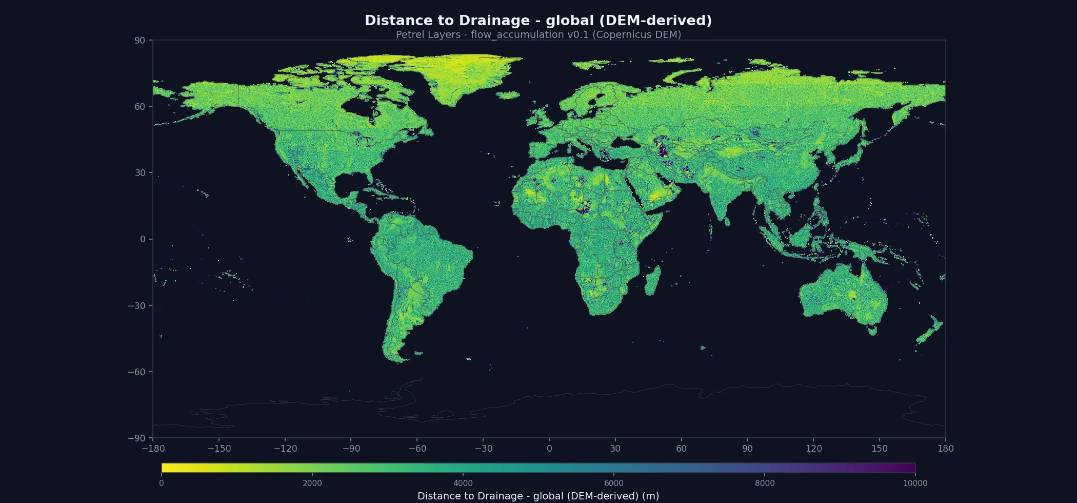
A free drainage dataset for the community: distance-to-drainage and TWI, built entirely from the open Copernicus DEM — so it reaches your stack with no copyleft strings or flow-down obligations (CC-BY-NC). The same layers feed the Petrel landslide, soil-erosion, flood, and lahar chains. v0.1 is structurally validated (qualitative) — the quantitative HydroRIVERS benchmark lands with v1. ⚠ Quantified limitation (2026-09-09): upslope area is accumulated per tile with a 1° halo, so it under-counts on rivers that cross tiles — the Amazon captures 7.8% of its true basin area, the Mississippi 10.4%, the Danube 30.1%. Because TWI = ln(a/tan β), TWI reads roughly 1.2–2.6 units low on those major basins, and the channel network the distance band is thresholded from shares the same dependency. Local and small-catchment terrain is unaffected. A global two-pass accumulation is the v1 fix.
What ships in the bundle
2 global ~278 m (9 arcsec) GeoTIFFs (~7.5 GB total) plus the full documentation set. All files are Cloud-Optimized GeoTIFFs with internal tiling and overviews — fast for both bulk download and windowed reads.
Method
Inputs · Copernicus GLO-30 DEM — a single permissive input (clean-room HydroSHEDS/HydroRIVERS replacement, no copyleft flow-down)
Training labels · —
Method · pysheds fill → flow direction → accumulation on the Copernicus DEM; channels at an accumulation threshold, Euclidean distance + TWI derived per cell
Documentation
Open — no account needed. The data below requires a free API key.
- README — entry point + quick start
- Methodology — how the model was built
- Model card — intended use, biases, limitations
- Data sources — input data citations
- Validation report — accuracy + known limitations
- Changelog — vintage evolution
- Licence — terms of use for this layer
- Citation — how to cite this dataset
- API usage — code snippets
- Bulk download — fetching the whole bundle
Download
Free for academic, research, and other non-commercial use. Account required.
# $PETREL_API_KEY = your API key (tlk.…) from the dashboard — free tier works.

# 1. Fetch 1-hour signed URLs for every file in the bundle:
curl -s -H "X-API-Key: $PETREL_API_KEY" \
  https://api.petreldata.io/v1/layer/flow_accumulation/v0.1/bundle > bundle.json

# 2. Download the full layer (~7.5 GB):
mkdir -p flow_accumulation_v0.1
jq -r '.files[] | [.url, .name] | @tsv' bundle.json | \
  while IFS=$'\t' read -r url name; do
    curl -s "$url" -o "flow_accumulation_v0.1/$name"
doneLicense & citation
License: CC-BY-NC-4.0. Free for academic, research, and other non-commercial use. For commercial licensing, contact petreldata.io@gmail.com.
Citation:
Petrel (2026). Petrel Flow Accumulation v0.1.
https://petreldata.io/layers/flow_accumulation
CC-BY-NC-4.0
Version history
- Initial release. Flow accumulation and its drainage sub-layers derived entirely from the Copernicus GLO-30 DEM (pysheds fill → flow-direction → accumulation), so the product is Petrel-owned and carries no third-party redistribution obligations. Ships two sub-layers at ~278 m (9 arcsec) globally: distance-to-drainage (metres to the nearest channel, ≥1000 accumulated cells) and the topographic wetness index (TWI). Raw accumulation is held as an internal intermediate for this vintage.
- A commercially-clean replacement for HydroSHEDS/HydroRIVERS. Built as a drop-in drainage layer whose single permissive input lets it be both given back to the community (CC-BY-NC-4.0) and embedded cleanly inside Petrel's paid hazard models — the copyleft-flavoured HydroSHEDS licence never touches them.
- Native-honest resolution. Ships at the true 9 arcsec derivation grid (_278m), not an interpolated 90 m; the filenames carry the real resolution.
- v0.1 caveat — QUANTIFIED 2026-09-09, and TWI is affected. Derivation is halo-tiled (~110 km overlap), so accumulation is under-counted wherever a catchment crosses tiles. Measured against true basin areas: Amazon 7.8%, Mississippi 10.4%, Congo 17.5%, Nile 22.7%, Danube 30.1%. ⚠ An earlier version of this entry said "channel geometry, distance-to-drainage and TWI are correct". That was wrong about TWI. TWI = ln(a / tan β) is a direct logarithm of the under-counted quantity, so the fractions above imply TWI reads 1.2–2.6 units low on those major basins — a wetness class on a 0–25 scale, not a rounding error. Widening the halo cannot fix it (the Amazon is ~3,000 km); a Barnes-style global two-pass accumulation is the v1 upgrade. Unaffected: local and small-catchment terrain, where the contributing area is contained within a tile, and the relative drainage structure within a tile. distance_to_drainage is thresholded from the same accumulation so it shares the dependency; its error has not been measured and is not claimed here. Antarctica is excluded by standard.
- Free, non-commercial Layer. Distributed under CC-BY-NC-4.0; a derived input data product rather than a paid Hazard. Commercial use is licensed separately.