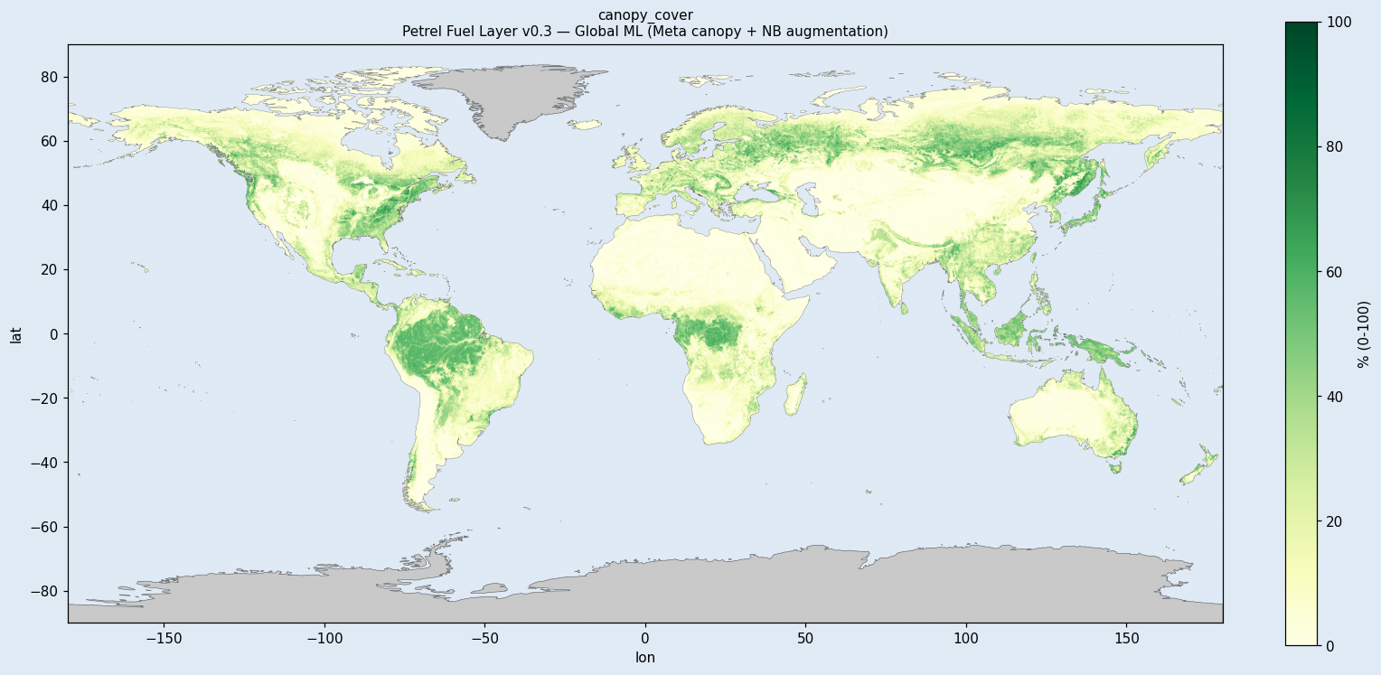
Fuel Layer
Feeds the Petrel Wildfire Hazard product. Scott-Burgan FM40 classification + canopy structure (cover, base height, stand height, bulk density). Greenland data-availability masked due to Meta GCH and WorldCover coverage gaps.
What ships in the bundle
5 global 90 m GeoTIFFs (~4.9 GB total) plus the full documentation set. All files are Cloud-Optimized GeoTIFFs with internal tiling and overviews — fast for both bulk download and windowed reads.
Method
Inputs · ESA WorldCover 2021, Meta For Good canopy heights (Tolan 2023), Copernicus DEM, Köppen-Geiger climate
Training labels · LANDFIRE LF2022 CONUS (FBFM40 + canopy regression targets), augmented with ~12k global non-burnable samples from WorldCover
Method · XGBoost multi-class + per-class regressors
Documentation
- README — entry point + quick start
- Methodology — how the model was built
- Model card — intended use, biases, limitations
- Data sources — input data citations
- Validation report — accuracy + known limitations
- Changelog — vintage evolution
- Citation — how to cite this dataset
- API usage — code snippets
Download
Free for non-commercial use. Account required.
# 1. Get a 1-hour signed URL
URL=$(curl -s -H "Authorization: Bearer $PETREL_API_KEY" \
  https://api.petreldata.io/v1/layer/fuel/v0.3/bundle \
  | jq -r '.download_url')

# 2. Mirror the full layer (~4.9 GB):
aws s3 sync $URL ./fuel_v0.3/License & citation
License: CC-BY-NC-4.0. Free for academic, research, and other non-commercial use. For commercial licensing, contact licensing@petreldata.io.
Citation:
Petrel (2026). Petrel Fuel Layer v0.3.
https://petreldata.io/layers/fuel
CC-BY-NC-4.0